Tour of Jotunheimen

Profile maps


The table below contain data from different parts of the Tour of Jotunheimen trail.
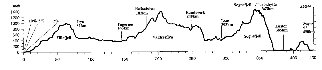
                          d.km     acc.alt.  acc.desc.  min.alt.  max.alt.
Lærdal - Filefjell          63         1036         32         9      1013
Filefjell - Fagernes        82          167        812       360      1013
Fagernes - Valdersflya      59         1237        216       368      1389
Valdresflya - Randsverk     45           91        737       738      1389
Randsverk - Lom             44          366        739       370       900
Lom - Sognefjell            50         1186        120       370      1436
Sognefjell - Gaupne         58          202       1628        10      1436
Gaupne - Sogndal            29          334        333         8       315
TOTAL                      430         4619       4617         8      1436
profile map
A complete profile map with names of each food station. Below is the same map split into three parts for more detail information.

profile map
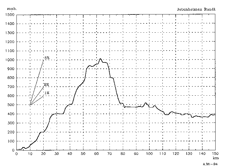
This profile map show the first one third of the trail in detail.

profile map
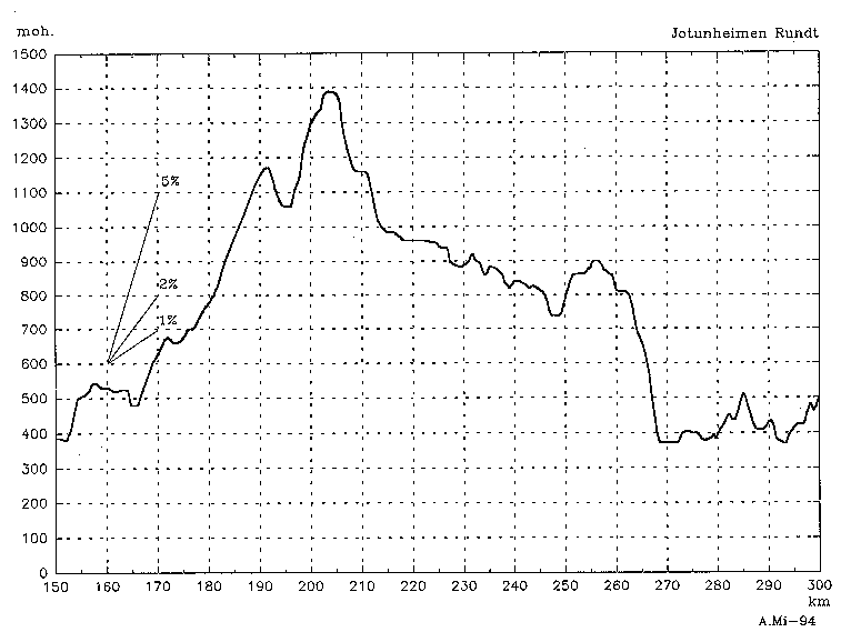
The second third of the trail.

profile map
The last part of the trail.

The maps has been made by Arne Mikkelsen.


Back to the main page for Tour of Jotunheimen
Back to Jørn's Cycling Homepage

Last modified Tuesday the 25. of May, 1999
I made this! Jørn Dahl-Stamnes